
Services
Our services extend from heavy computational tasks to working with our partners to conduct complex field studies. Deliverables can be provided as GIS spatial data, pdf reports and spreadsheets, and integrated into an interactive web application.

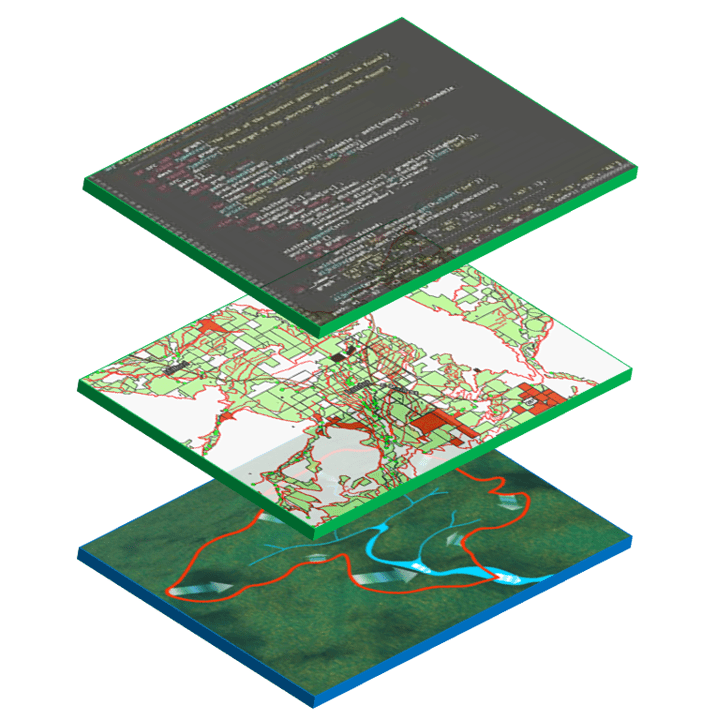
GIS Mapping and Analysis
We use GIS and programming products to digitize, analyze, and publish information.
Services Available:
- Digitize and map water rights and associated infrastructure using GIS software.
- Spatial analysis to identify trends, patterns, and anomalies in water right distribution and usage.
- Spatial analysis of field and conveyance slope, soils, and consumptive use.
- Develop maps to support water resource planning and management, including drought risk assessment and floodplain mapping.
- Machine learning tools to analyze irrigated area over time.
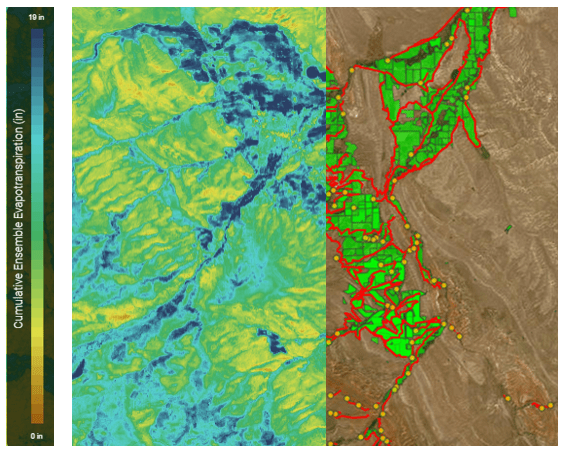
Hydrologic and Resource Allocation Modeling
We use hydrologic models including the TUWmodel, HBV, SWAT, and MIKE-SHE models to analyze watershed characteristics and determine natural hydrologic processes and water availability. Hydrologic model outputs can be coupled with a hydrologic-allocation model to simulate baseline water right demand and regulation, resource use, distribution, and hydrologic feedbacks.
Studies Available:
- Consumptive Use Studies
- Water use analysis (including water shortage and surplus)
- Water Right Compliance Studies
- Reservoir and Storage Dependency Analysis
- Environmental Flow Assessments
- Water Quality Proxy Analyses
- Drought Risk and Vulnerability Analysis
- Climate Variability Sensitivity Analysis
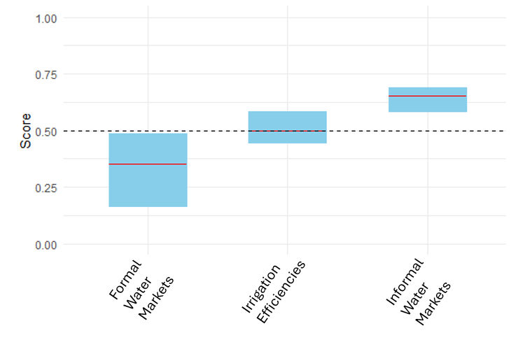
Scenario Analysis
We perform analyses to test the hydrologic and institutional effects of multiple scenarios.
Analysis Available:
- Water Use Infrastructure (changes to irrigation efficiencies)
- Canal Consolidation
- Reservoir Construction or Expansion
- Water Markets (formal and informal)
- Changes to Place of Use and Point of Diversion
- Demand Management
- Law and Policy
- Vulnerability Analysis under Climate Scenarios
Decision Support Systems
Using both Multi-Criteria and Multi-Objective Decision Support Systems (DSS), scenarios can be analyzed relative to baseline conditions to understand tradeoffs across multiple objectives and stakeholder preferences.
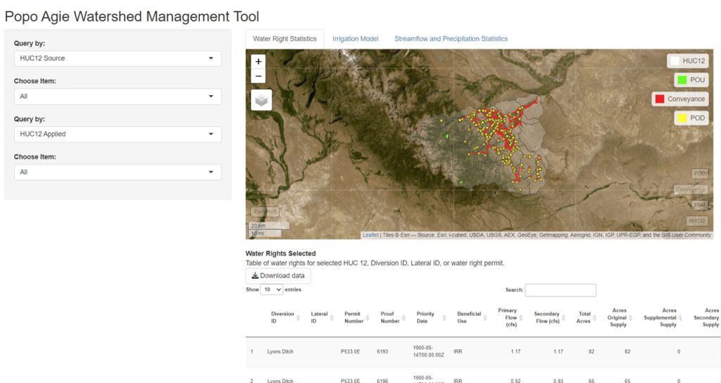
Web Application
Our services include providing data, results, and analysis in a web application to ensure answers to your questions are always available.
Features Include:
- A shiny web application to host your GIS data and generate downloadable statistics, figures, and maps as a deliverable for any service provided.
- Application is updatable for new scenario analysis and recent watershed infrastructure updates.
- Customizable to your specifications.
