Projects
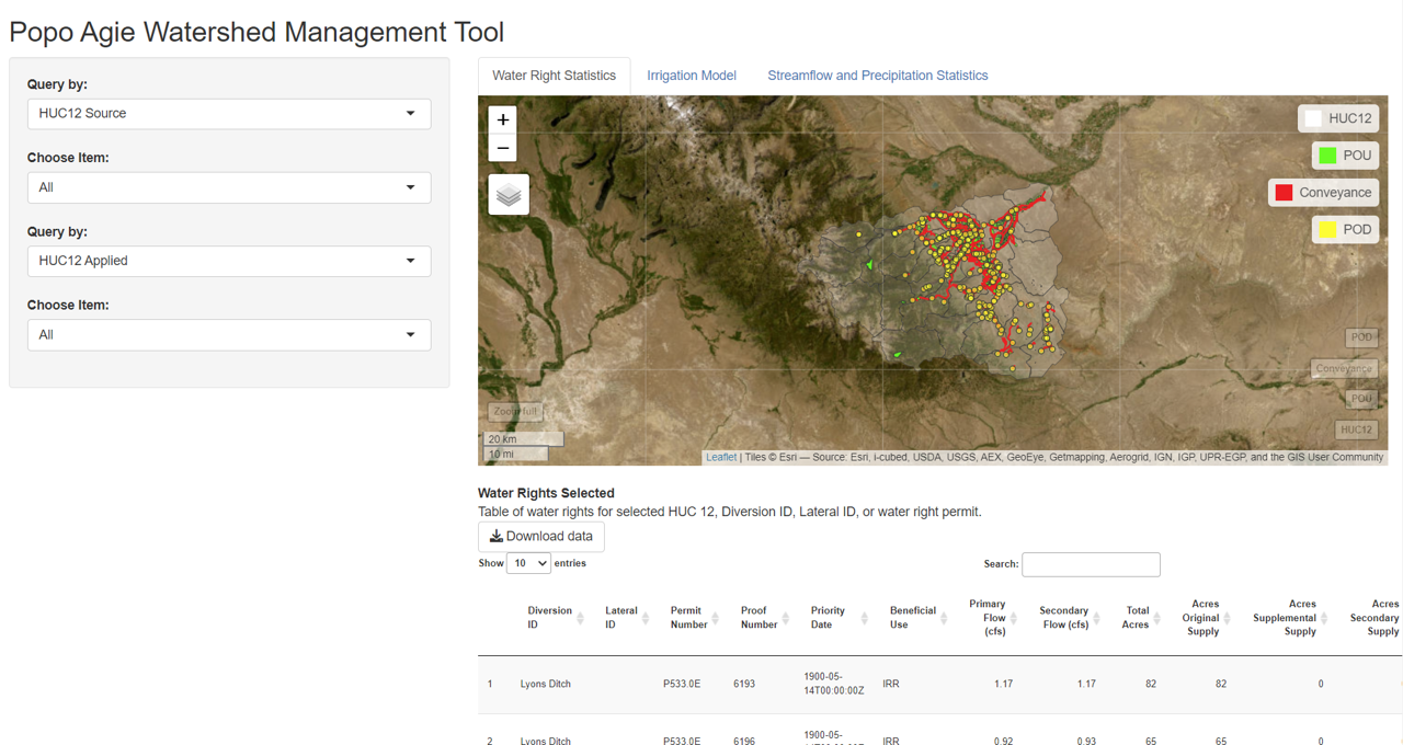
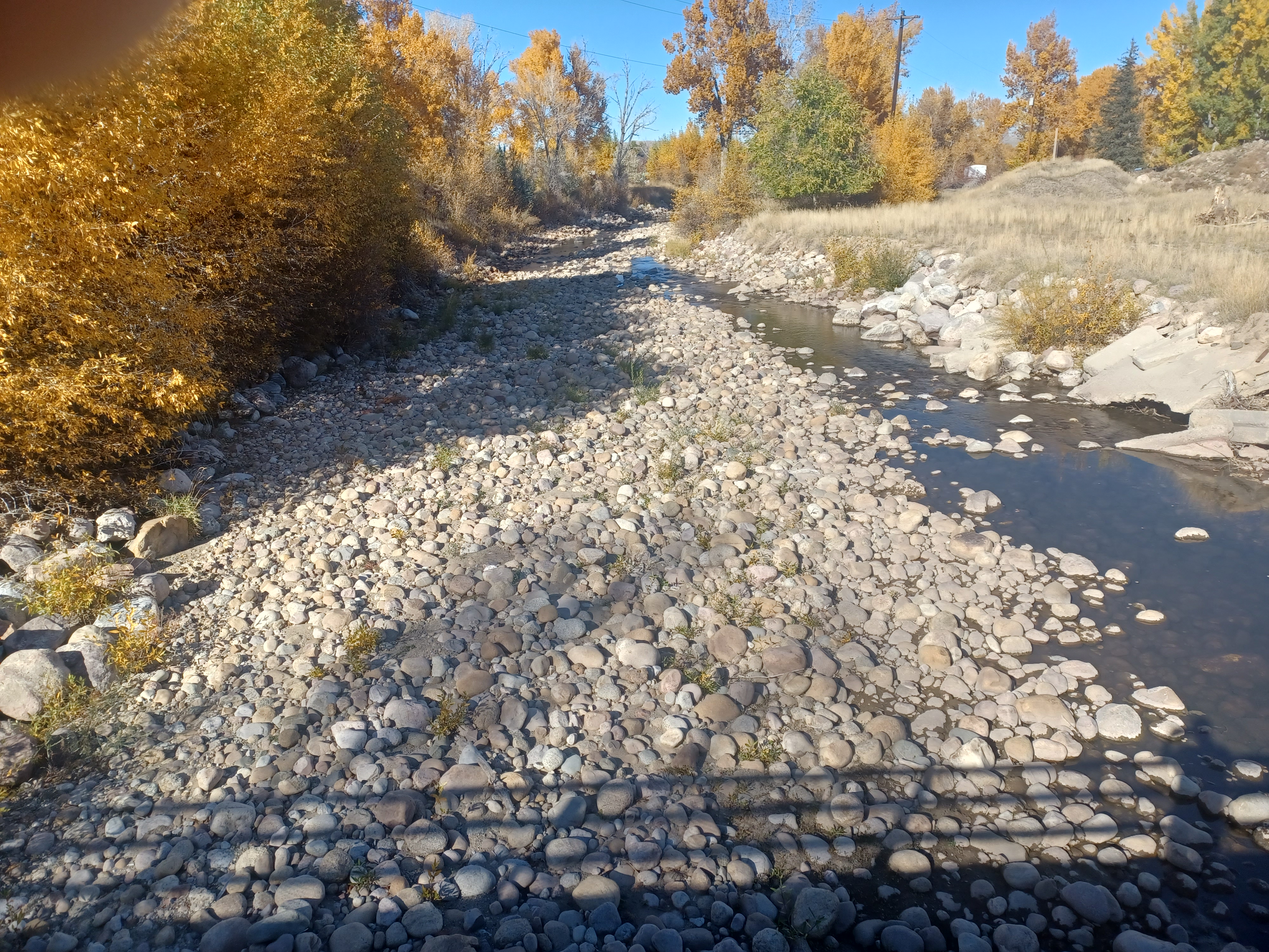
Popo Agie Watershed, WY
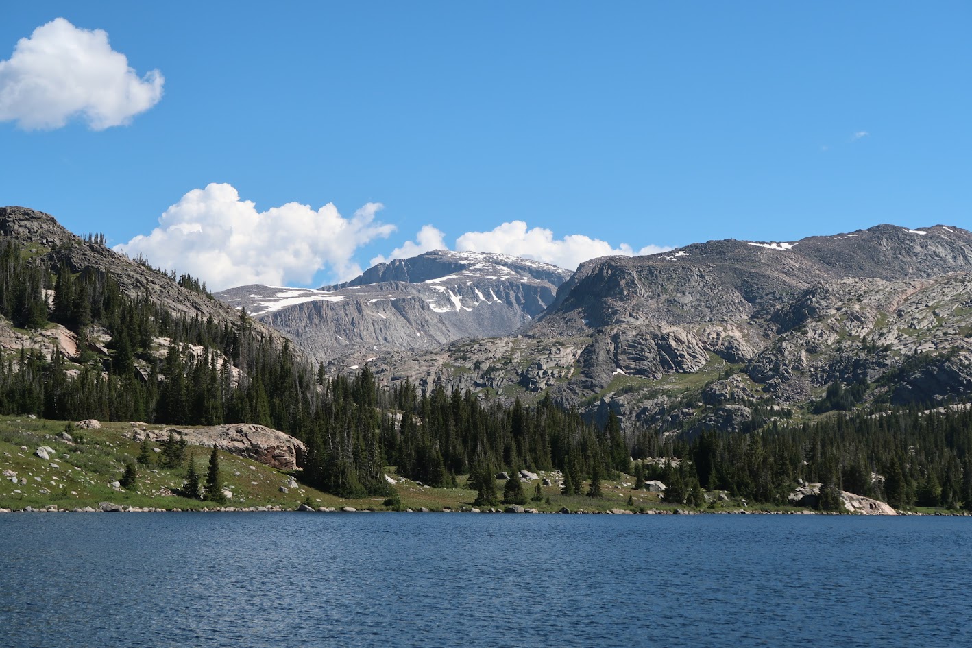
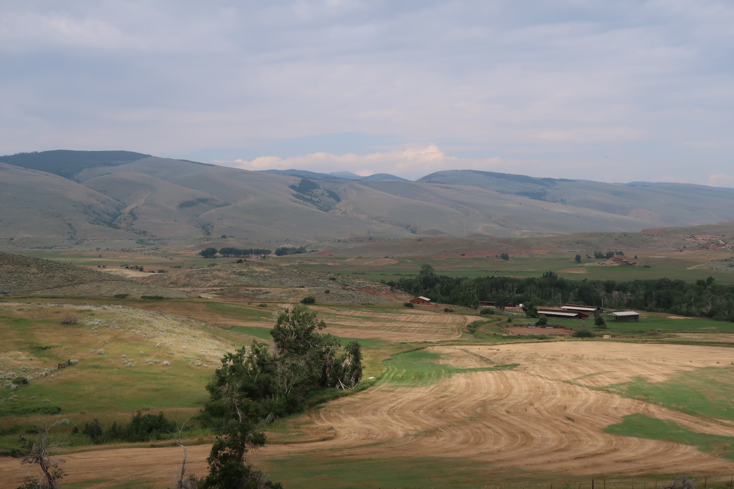
Draining the rugged southeastern flanks of the Wind River Range, the Popo Agie watershed offers water resources to a rich and diverse economy of irrigation, recreation, and tourism. The Middle Popo Agie River, which flows through the town of Lander, is depleted during normal to dry water years due to high irrigation demand upstream of town. The lack of streamflow dampers fish propagation and degrades water quality.
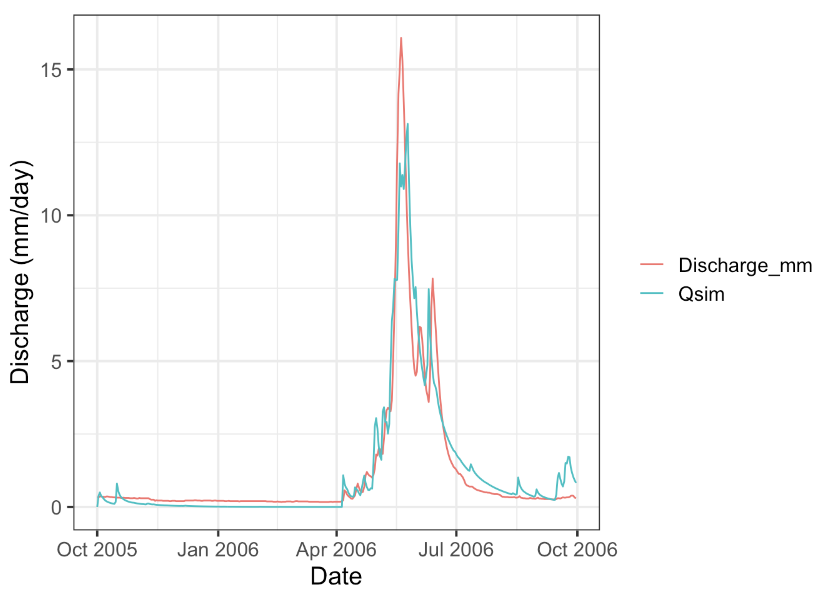
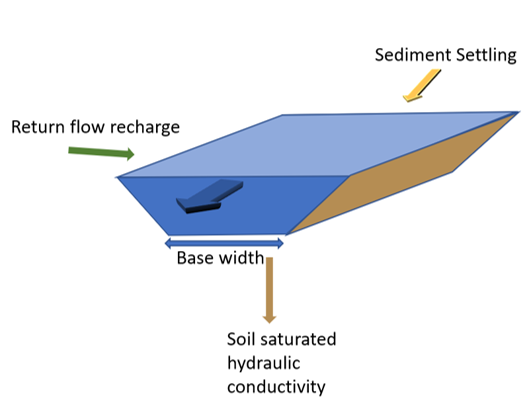
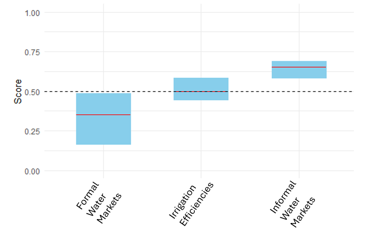
The Healthy Rivers Initiative (HRI), a collaborative of local to federal agencies, has been investigating potential water conservation investments to increase streamflow in the Middle Popo Agie River. HydroScape Analytics has assisted in HRI’s mission by developing a Decision Support System which leverages a biophysical-allocation-hydrologic coupled model to investigate tradeoffs between irrigation efficiency updates, informal and formal water markets, and reservoir storage capacity increase. We built a web application for HRI which allows them to visualize and query water right and associated infrastructure, model results such as canal seepage loss and return flow distribution, and results from the decision support system.
Clear Creek Watershed, WY
The Clear Creek watershed, situated on the eastern flanks of the Bighorn Mountains in Wyoming supports ranching and the town of Buffalo and Story. A history of overallocation often leaves many junior water right holders out of priority for much of the season. In addition, a growing population in Buffalo has increased the need for additional future water supply.
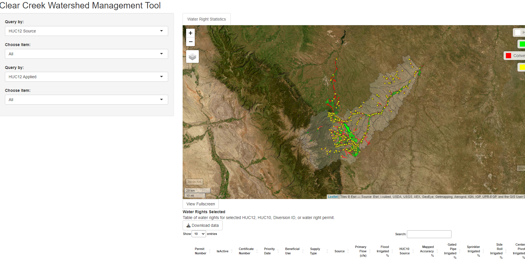
The Clear Creek Conservation District has interest in understanding water availability for sustainable population growth. HydroScape Analytics has assisted in Clear Creek Conservation District’s mission by developing a Decision Support System which leverages a biophysical-allocation-hydrologic coupled model to investigate tradeoffs between irrigation efficiency updates, informal and formal water markets, and reservoir storage capacity increase. We built a web application for the Conservation District which allows them to visualize and query water right and associated infrastructure, model results such as canal seepage loss and return flow distribution, and results from the decision support system.